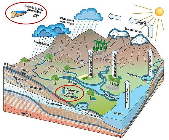
Observing the temporal variations of the Earth gravity field by satellite gravimetry, terrestrial gravimetry or loading time series via GNSS gives insight into the temporal and spatial changes in the distribution of water on various scales. The overall aim of this project is to develop models of regional time-variable gravity (or, equivalently, of total water storage variations) at uttermost high spatial and temporal resolution by the consistent integration of the various geodetic sensors. The project thus tackles one of the currently most pressing challenges in geodesy and its dependent geophysical applications.
In addition to data from the satellite missions GRACE and GRACE Follow-On and loading time series derived from GNSS, we will capitalise on the fortunate situation that absolute and relative terrestrial gravimeters of various types will be available to this project. Especially, we will benefit from the deployment of absolute quantum gravimeters allowing us to set the ground for the next generation of gravimetric monitoring networks based on more flexible and precise technology.


 ©
GFZ
©
GFZ
Objectives of C05 - Modelling of Mass Variations Down to Small Scales by Quantum Sensor Fusion
- Deploy quantum gravimeters in an observation network in the Elbe River basin.
- Combine satellite-based gravimetry, GNSS displacements and terrestrial absolute and relative gravimetry.
- Develop a Kalman filter approach for a regional gravity field modelling based on space localising (radial) basis functions.
- Derive observation-based total water storage variations at scales smaller than 100km.
Executing Persons
Principal Investigators
Early Career Researchers
Publications
Showing results 1 - 3 out of 3


